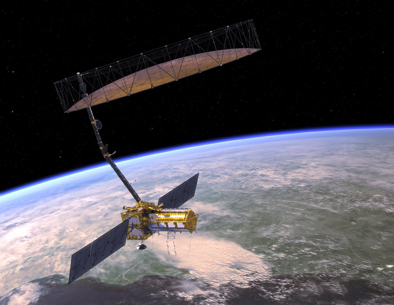
The NASA-ISRO SAR (NISAR) Mission will measure Earth’s changing ecosystems, dynamic surfaces, and ice masses providing information about biomass, natural hazards, sea level rise, and groundwater, and will support a host of other applications.
NISAR will observe Earth’s land and ice-covered surfaces globally with 12-day regularity on ascending and descending passes, sampling Earth on average every 6 days for a baseline 3-year mission.
Quick Facts
Artist's Concept of NISAR spacecraft
Artist's Concept
Planned Launch Date: 2022
The NASA-ISRO SAR (NISAR) Mission will measure Earth’s changing ecosystems, dynamic surfaces, and ice masses providing information about biomass, natural hazards, sea level rise, and groundwater, and will support a host of other applications.
NISAR will observe Earth’s land and ice-covered surfaces globally with 12-day regularity on ascending and descending passes, sampling Earth on average every 6 days for a baseline 3-year mission.
Launch and Deploy Animation of the NASA-ISRO SAR (NISAR) spacecraft
Mission Characteristics:
Orbit Altitude :-747 km
Orbit Inclination :-98.4°
Repeat Cycle :-12 days
Time of Nodal Crossing :-6 AM/ 6 PM
Orbit Control :-< 500 m
Pointing Control :-< 273 arcsec
Pointing Left (south)
L/S Duty Cycle :-> 50%/10%
Baseline Mission Duration :-3 years
Consumables :-5 years
Data and Product Access :-Free & open
Wavelength L-band: :-24 cm
S-band: :-9 cm
SAR Resolution :-3–10 m mode-dependent
NISAR will add a tremendous new data set to create new and greatly improve upon existing applications. By virtue of the planned frequent and regular sampling of some of the world's most hazard-prone areas, these data will be a rich source of information to guide development of applications and their associated scientific studies. They will be a reliable data source over the life of the mission for proactive planning for disasters, and will have a store of pre-disaster images available to rapidly understand what transpired in the disaster, leading to the development of actionable applications that could inform the government for consideration of future operational missions. Water resource monitoring, infrastructure monitoring, and other value-added applications will also be revolutionized by access to these data. To learn more about applications, there is more information in the Applications White Papers.
The NISAR Utilization Plan defines “applications” as engagement between the NISAR project and the broader stakeholder community with the purpose of increasing the utility, accessibility and discoverability of NISAR data. Specifically by: demonstrating the value of the NISAR mission within a broad societal context, supporting activities that engage a diverse user community, educating a broader community on the utility of SAR data, working with interested end users to develop information products, and contributing to an observation plan and data delivery schedule that facilitates both science and applications within mission constraints.
There are multiple pathways to engage with NISAR:
Follow us via semi-annual newsletters by signing up for the application mailing list
 Participation in NISAR Application Workshops
Invited participation in focused, charter-driven working groups dedicated to facilitating progress towards the overarching goal of increasing the applications potential of NISAR data
Invited participation as a NISAR Envoy Member to receive updated information on the project for distribution at professional meetings and conferences
Early Adoption of NISAR by integrating NISAR-like data into algorithms and workflows and joining the Community of Practice (CoP).
Comments
Post a Comment
If you have any doubt let me know in the comment section where i can try to solve it .
Thank you